IMPORTANT INFO
Cross country Mountain biking and hiking around Atlin
(Please note: these routes were mapped over a number of years, and conditions may have changed).
For mapping, we recommend using the Gaia app (no they do not sponsor us, it's our real opinion) which has many of the historic Atlin roads mapped.
Please note:
This website is made to offer you a bit of guidance, you are responsible for your own preparation, mapping, safety and health.
There are NO TRAILHEADS, NO MARKERS.
These routes are CROSS COUNTRY mountain biking.
These routes are also used by vehicles, they are not dedicated hiking or biking routes.
If you are looking for Downhill/Enduro, there is the Como lake trail that was built in 2020.
We are just an innocent bunch of friends wanting to- and doing our best to share the fun there is to be had here, all on already existing roads!
You are and should be responsible for yourself. The wilderness around Atlin is wonderful, remote and vast and it is possible for weather conditions to change rapidly. Always be prepared for the worst, let someone know where you are going and bring an in reach for communications in case of emergency.
PLEASE RESPECT NATURE, WILDLIFE AND THE TRAILS.
Search and rescue teams will take time to get to you in case of an emergency so always be prepared to self rescue.
We are in bear country, please make appropriate precautions and be bear aware.
Let’s all enjoy these tracks/routes together in a respectful way. Please do not leave any garbage and please do not destroy any historical sites and please do not purposely disturb or bother wildlife.
Thank you for treading lightly.
Questions or comments? Please do not hesitate to contact one of us via our Facebook page www.facebook.com/atlinmountainbiking
Biking and hiking routes downloads
GPX FILES
| switchbacks_galore.gpx |
| lake_express.gpx |
| marmot_lake.gpx |
| gravity.gpx |
| crocus_trail.gpx |
| ruby_creek_and_boulder_creek_roads_loop.gpx |
| cracker_creek.gpx |
| macdonald_lake_to_gladys_lake.gpx |
| davenport.gpx |
| atlin_silver_to_surprise_pass.gpx |
| wilson_creek_from_parking_lot.gpx |
| dominion_creek_starting_from_creek_crossing.gpx |
COMPLETE TRAIL GUIDE WITH MAPS
Guide Does not include Boulder creek loop , Gladys lake road, Davenport, Atlin Silver Pass, or Cracker creek
| TRAIL GUIDE |
PDF FILES/MAPS
| Switchback Galore GUIDE (blue) |
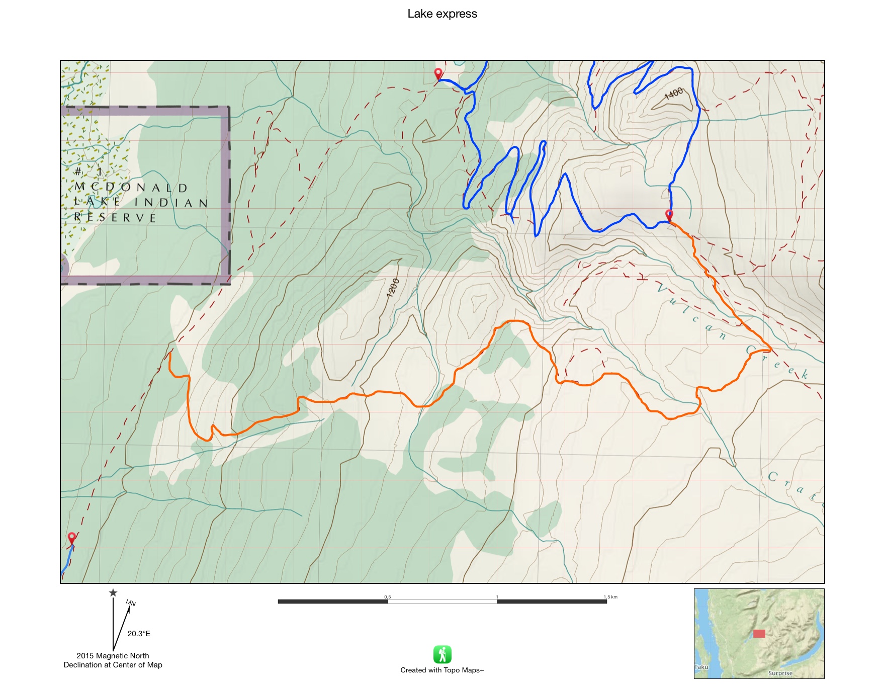
| Lake Express GUIDE (orange) |
| Marmot lake GUIDE (purple) |
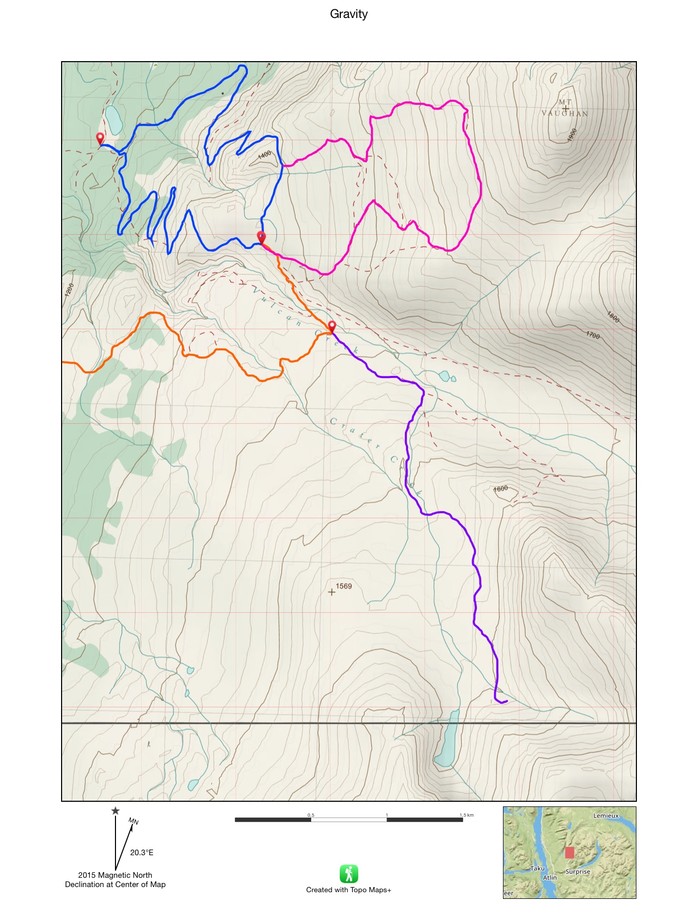
| Gravity GUIDE (pink) |
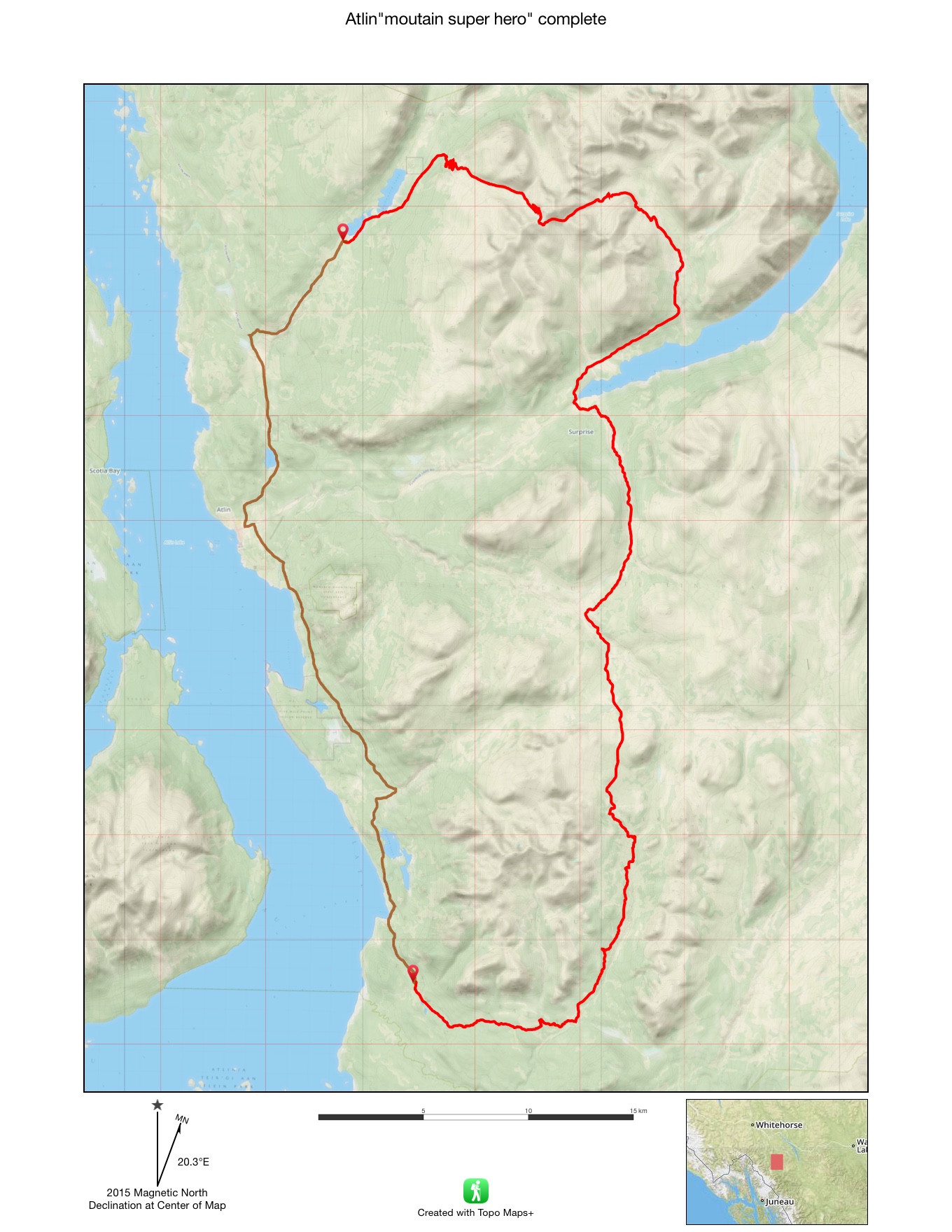
| Superhero GUIDE (80+km) |
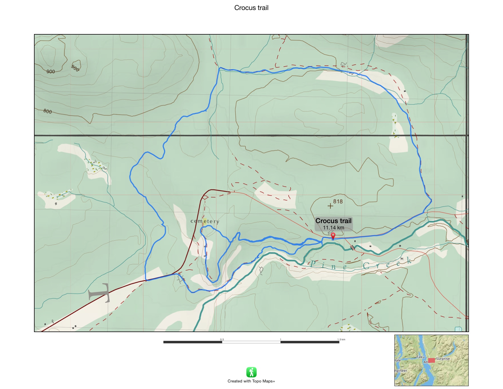
| Crocus trail by pine creek falls |
Routes mapped by Philippe Brient
